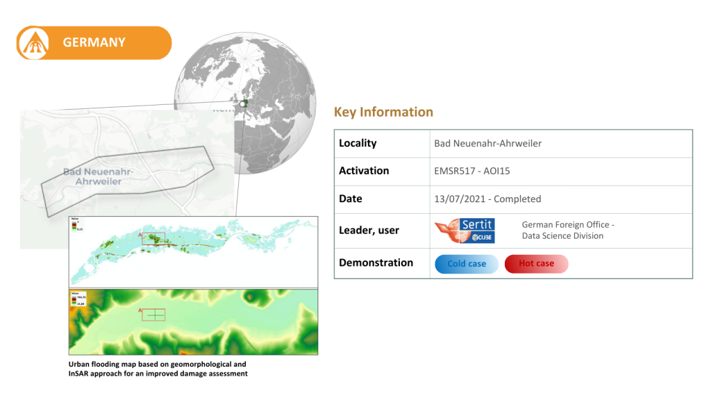
In July 2021, severe rainfall led to devastating floods in Germany’s Ahr Valley and tributaries of the Rhine and Saar. This event in particular is said to be one of the most destructive in the last five decades, causing up to 32 billion euros in damage in the affected regions. Rhineland-Palatinate, the location of this case study, has a medium hazard level for riverine floods. Bad Neuenahr-Ahrweiler and neighbouring villages were particularly affected, because of to their location downstream of steep slopes, with little to no natural mitigation factors to prevent destruction and loss of life.
This use case is now closed, and the analysis conducted throughout its duration showed great performances of most indicators and indexes in deep valleys. At the same time, results demonstrated that ancillary and reference data are penultimate in ensuring good performances. However, the comparison with reference datasets also revealed an underestimation of flood depth, indicating the need for additional finetuning to improve accuracy in highly variable floodplain environments.
Additional work is also required to find synergies between some indicators in the context of Copernicus Emergency Management Service (CEMS) On-Demand Mapping activities for emergency response, particularly to optimise integration during crisis activation scenarios.
In total, this event has caused more than 200 fatalities in Germany and Belgium, and the CEMS On-Demand Mapping team has been activated twice to monitor the consequences of the event (EMSR517 and EMSR518). Bad Neuenahr-Ahrweiler was Germany’s hardest-hit city, with an estimated 117 death toll.
Indicators to be tested:
Historical 6 hourly return period precipitation maps
Machine Learning data driven forecast of return period-based precipitation events in urban areas
Urban inundation probability maps and water depth defined by return period at a spatial resolution lower than 10m