The Ebro River basin in Spain, characterised by recurrent flood episodes and a medium level of river flood hazard, provides a unique context. Since the 1960s, the channelling of the Ebro River and its tributaries, coupled with rapid urbanisation and soil sealing, has increased both the frequency of floods and the damage they cause. In response, comprehensive initiatives, including hydro-geomorphological restoration and improved land planning, have been implemented to progressively reduce flood risks.
This use case draws on an extensive archive of meteorological data, land cover metrics, and hydrological records, in addition to VHR LiDAR scans, to assess the effectiveness of CENTAUR in regions with complex river systems and urban layouts. In particular, the use case will be focused on the exceptional flooding episode which affected the Ebro River basin in April 2018, caused by snowmelt in the Pyrenees.
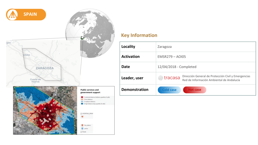
The results obtained from the evaluation of the indicators are promising and highlight the potential of the CENTAUR system as a reliable tool for meteorological forecasting within the context of flood risk assessment. The validation of the socioeconomic indicators confirms that they are operationally applicable in areas with characteristics comparable to those of the Zaragoza Use Case, reinforcing their potential for broader deployment. Additionally, the End Users involved in the Spanish Use Case (Spanish Civil Protection and REDIAM) provided direct feedback, demonstrating strong engagement and helping validate the products from an operational perspective.
Indicators to be tested:
Historical 6 hourly return period precipitation maps
Machine Learning data driven forecast of return period-based precipitation events in urban areas
Urban inundation probability maps and water depth defined by return period at a spatial resolution lower than 10m